Hemelsdaeleroute
Woumen
A rural loop from Woumen, with wide views from the Hoge Kam, old roads, small chapels and the story of Hemelsdaele.
The walk
The Hemelsdaeleroute is a 9.8-kilometre loop from Woumen towards the higher ground around Esen and Klerken. The first part follows residential streets and the Steenstraat for quite some distance, but the route becomes much quieter later on, with broad views across the Krekedal, the Yser valley and the wider Westhoek. Along the way, open countryside is mixed with several layers of local history.
From Woumen to the Steenstraat
The walk begins at Saint Andrew’s Church in Woumen. The history of the site goes back to a wooden place of worship from the late 11th century. The church was destroyed during the religious unrest of 1583 and restored at the beginning of the 17th century.
During the First World War, German troops used the tower as an observation post. In the devastated landscape it became an obvious target, and the church was eventually destroyed completely. It was rebuilt after the war. Fire struck again in 1985, destroying the interior and leaving only the outer walls, tower and sacristies intact.
From the village, the route first follows residential streets towards the Steenstraat. This long, straight road has a much older history than its modern appearance suggests. In the Roman period, it formed part of a secondary route connected to the road between Boulogne-sur-Mer and Cologne. It remained an important thoroughfare during the Middle Ages.
This was the part of the walk I found least interesting. There is quite a long stretch on paved roads, and it does not yet feel like the most rewarding part of the route. That gradually changes as you approach Klerken and the surroundings become quieter.
Predikboom and the Hoge Kam
Along the Steenstraat, the route passes close to the Predikboom site. During the First World War, the Germans positioned a 38 cm Krupp gun here. From April 1915, it fired mainly towards Dunkirk, roughly 38 kilometres away.
The concrete base still survives behind a farm at Steenstraat 38, but it stands on private property and cannot be visited. It is an unusual reminder of the military history hidden in what is now a very peaceful landscape.
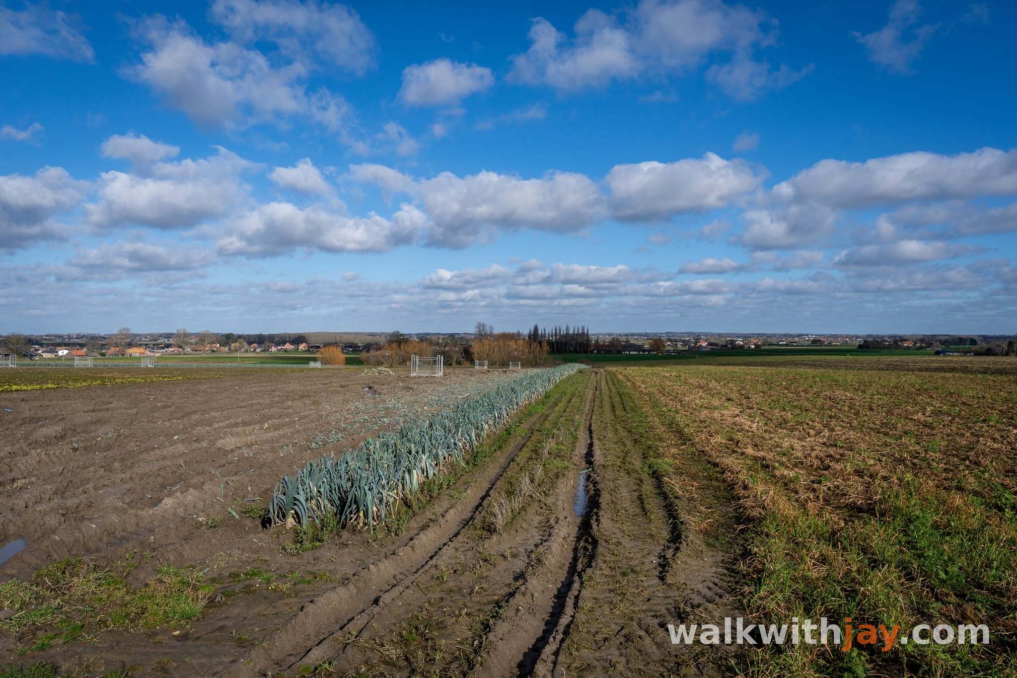
The walk then continues via Klerkenstraat and Hoge-Kamstraat, where the route becomes much more enjoyable. At around 37 metres, the Hoge Kam is the highest point in Diksmuide. From the ridge there are wide views across the Krekedal and the Yser valley. In clear weather, you can see much farther, towards the coast, the Wijnendale plateau and the hills of the Westhoek and French Flanders.
At the end of the Hoge Kam stands a small wayside chapel dating from 1848 and rebuilt after the First World War. Locally it is known as the Krukkenkapel, or ‘Crutches Chapel’. According to local tradition, Francine Despeghel came here to pray every day and hung her crutches in the chapel after her recovery.
The story of Hemelsdaele
Kruisstraat leads towards the long driveway of Hemelsdaelehoeve. A Cistercian community for women was founded on this site in 1237 after Elisabeth van Steenvoorde donated her estate at Esen to the Abbey of Marquette near Lille.
In 1242, the community received permission to hold religious services, although the parish of Esen retained certain rights connected with burials and offerings.
The monastery remained at Esen for only 33 years. The community later moved to Zillebeke, Werken and Diksmuide before eventually settling in Bruges. The land at Esen remained connected with the abbey, and the name Hemelsdaele continued to be used. It refers to the valley between the ridges of Esen and Klerken.
Today, the farm at the end of its long driveway remains a quiet reminder of this medieval history.
Back to Woumen via the Warande
On the return towards Woumen, the route passes the Warandekapel, formerly known as the Roompot chapel. A small Marian chapel already stood here before the First World War, and historic maps show a chapel on the site as far back as the 18th century.
A simple concrete chapel was built after the war, but it later had to make way for the widening of the provincial road. The present, larger chapel was built in 1948.
From the Warande, the route gradually returns to Woumen and Saint Andrew’s Church. For me, it is the second half of the loop, particularly the Hoge Kam and the quieter country roads around Esen and Klerken, that gives this walk most of its appeal.
Jay’s tips
Take a few minutes to enjoy the view from the Hoge Kam. For me, this is the most enjoyable part of the walk and the point where the landscape really opens up.
Good to know
Little shade
Bus stop near the start
Church
Chapel
Most of the route is paved. The views from the Hoge Kam are best in clear weather, when you can see far across the Westhoek. The remains of the Predikboom gun position are on private property and cannot be visited.
My experience
I enjoyed the Hemelsdaeleroute much more once the long section along the Steenstraat was behind me. The opening stretch is quite road-heavy and did not appeal to me as much, while the Hoge Kam and the quieter country lanes around it offer much more atmosphere and some genuinely good views.
The stories connected with Predikboom, the Krukkenkapel and Hemelsdaele make the walk more interesting and add useful context to the landscape. Even so, there are other routes in this part of the Westhoek that I would choose first.
If you are already in the area and enjoy quiet country roads, open views and local history, the Hemelsdaeleroute is still a pleasant option.
Waymarking
Hemelsdaeleroute
Places of interest

Sint-Andreaskerk Woumen
At start/finish
A reconstruction-era church on a much older religious site. It was destroyed during the First World War and extensively restored again after the fire of 1985.
Hoge Kam
Along the route
At around 37 metres, this is the highest point in Diksmuide, with broad views over the Yser valley and Westhoek and, in clear weather, as far as the coast.

Hemelsdaelehoeve
Along the route
Farm on the site where a Cistercian community for women was founded in 1237. The name Hemelsdaele remained attached to the land after the community moved away.
Kruisstraat 39, 8600 Diksmuide, Belgium ↗
Website →Ready to set off?
Open the starting point in your GPS and enjoy the walk.